Thornton le Dale map

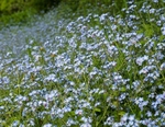
Thornton le Dale is a village which is about 2-3 minutes drive due east of Pickering. It’s a charming and slightly olde-world village centre which caters well for visitors. This is a short 4 kilometre walk on a circular route up into the Ellerburn valley and down the other side back into Thornton (marked here in purple). This walk takes in woodland paths with an abundance of wild flowers, plus impressive wide views over the Yorkshire Wolds and also into the Ellerburn valley.
Several walks can be started from here running north into Dalby forest and I would highly recommend buying an excellent and beautifully illustrated booklet called “Wildflower Walks around Pickering, Thornton Dale, Dalby Forest” by Nan Sykes which contains many walks into the area. It may now be out of print but it may still be possible to buy one locally
I used the OS map which can be seen here on this link: OS map
|
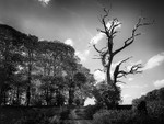
Also in: Photographic Walks in North Yorkshire 2018
 |  |  |  |  |
 |  |  |  |  |
 |  |  |  |  |