Spofforth Walk map
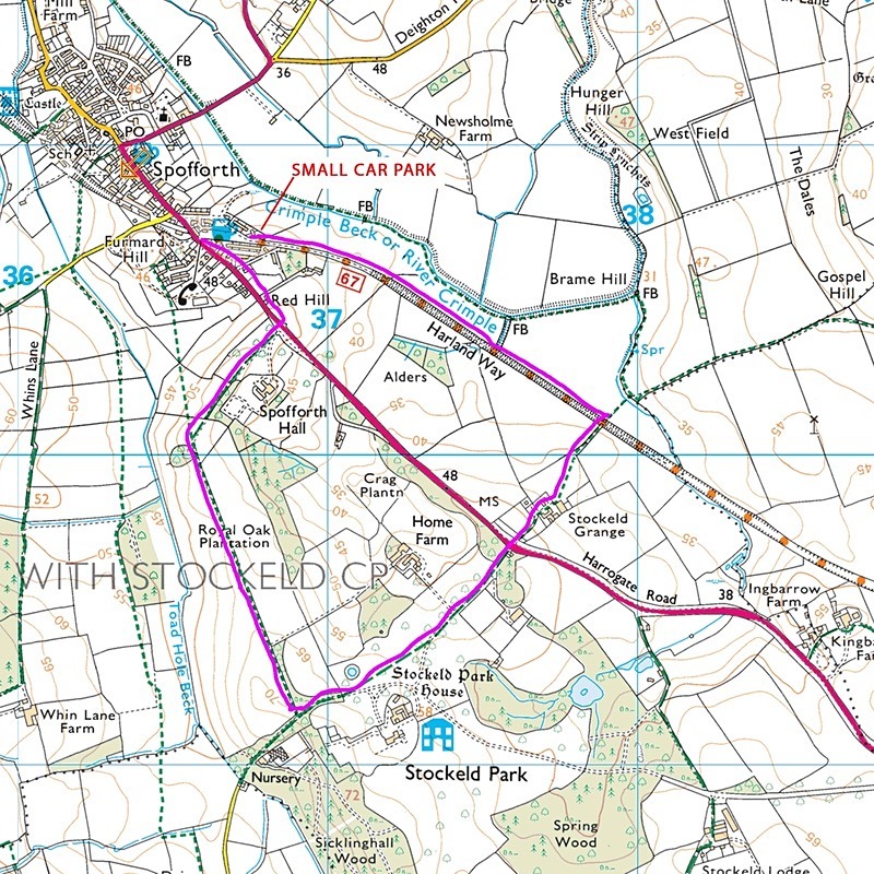
This is a lovely short 4 kilometre walk from the village of Spofforth near Harrogate. As you drive into Spofforth from the York direction, there is a sharp right downhill turning off Harrogate Road into a small housing estate. Drive down through the estate for about 100 yards and there is a small car park on the left by the children’s playground.
Fifty yards further on through the estate is the beginning of Harland Way, the disused railway track. Continue along Harland Way for about 1.5 kilometres until you come to a lane which crosses the path. Turning left will take you to Crimple beck but turning right will take you back on a circular route through Stockeld Grange farm and then over the Harrogate Road and through Stockeld Park. Watch out for a right turning on a broad path alongside a wood. If you reach Sicklinghall wood on your left, you have gone too far down the path. This right turning will take you on the return journey back to Spofforth.
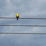
I walked this route in early May. Because of the exceptionally late 2018 spring, the different coloured beeches in Stockeld park had just come into leaf. Also, there were many wild flowers such as bluebells, jack by the hedge and so on which were in full bloom. It was a sunny day at mid-day and so the light was harsh and unremarkable, however, the walk was alive with all kinds of wildlife along the disused railway.
I recommend using the OS map at this link here:
http://www.streetmap.co.uk/map.srf?x=436500&y=451500&z=120&sv=spofforth&st=3&tl=Map+of+Spofforth,+North+Yorkshire+[City/Town/Village]&searchp=ids.srf&mapp=map.srf
Fifty yards further on through the estate is the beginning of Harland Way, the disused railway track. Continue along Harland Way for about 1.5 kilometres until you come to a lane which crosses the path. Turning left will take you to Crimple beck but turning right will take you back on a circular route through Stockeld Grange farm and then over the Harrogate Road and through Stockeld Park. Watch out for a right turning on a broad path alongside a wood. If you reach Sicklinghall wood on your left, you have gone too far down the path. This right turning will take you on the return journey back to Spofforth.
I walked this route in early May. Because of the exceptionally late 2018 spring, the different coloured beeches in Stockeld park had just come into leaf. Also, there were many wild flowers such as bluebells, jack by the hedge and so on which were in full bloom. It was a sunny day at mid-day and so the light was harsh and unremarkable, however, the walk was alive with all kinds of wildlife along the disused railway.
I recommend using the OS map at this link here:
http://www.streetmap.co.uk/map.srf?x=436500&y=451500&z=120&sv=spofforth&st=3&tl=Map+of+Spofforth,+North+Yorkshire+[City/Town/Village]&searchp=ids.srf&mapp=map.srf
|
Also in: Photographic Walks in North Yorkshire 2018
 |  |  |  |  |
 |  |  |  |  |
 |  |  |  |  |