Hovingham Walk 1
Hovingham is a beautiful and slightly quaint old stone village, west of Malton. There are several walks that you can begin from there and because of this, I've marked this particular route in red on the map. In the village, there is a cafe (with toilet) and plenty of parking space on the road outside (marked in red).
This walk is about 6 kilometres long (about two hours at a stroll) and passes through beautiful woodland and across hills with great views over the wolds in many directions. I was there on a beautiful but photographically uninteresting day with a clear blue sky at mid-day so these images reflect that situation. In evening light this walk will be exceptional.
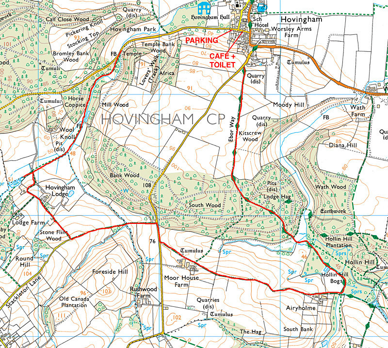
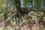
From the village, walk further down the Coulton road running west. Turn left when reaching the waymark on the left signed for Coulton (pictured in the first image). Follow the path down through the woodland - watch out for the large redwoods and out onto the wolds. The way runs through clear paths and tracks until you get into the woodland again where it joins the Ebor Way. You may need this large-scale detailed map, here because there are several paths join at the bottom of the woodland. Follow it uphill through the wood and then out the other side and over the hill for spectacular 360 degree views with skylarks, butterflies and wildflowers on the path down back into Hovingham.
You can print off this map here: http://www.streetmap.co.uk/idld.srf?x=466500&y=475500&z=120&sv=466500,475500&st=4&mapp=idld.srf&searchp=s.srf&dn=752&ax=466500&ay=475500&lm=0
This walk is about 6 kilometres long (about two hours at a stroll) and passes through beautiful woodland and across hills with great views over the wolds in many directions. I was there on a beautiful but photographically uninteresting day with a clear blue sky at mid-day so these images reflect that situation. In evening light this walk will be exceptional.
From the village, walk further down the Coulton road running west. Turn left when reaching the waymark on the left signed for Coulton (pictured in the first image). Follow the path down through the woodland - watch out for the large redwoods and out onto the wolds. The way runs through clear paths and tracks until you get into the woodland again where it joins the Ebor Way. You may need this large-scale detailed map, here because there are several paths join at the bottom of the woodland. Follow it uphill through the wood and then out the other side and over the hill for spectacular 360 degree views with skylarks, butterflies and wildflowers on the path down back into Hovingham.
You can print off this map here: http://www.streetmap.co.uk/idld.srf?x=466500&y=475500&z=120&sv=466500,475500&st=4&mapp=idld.srf&searchp=s.srf&dn=752&ax=466500&ay=475500&lm=0
|
Also in: New Photographic Walks 2017
 |  |  |  |  |
 |  |  |  |  |
 |  |  |  |  |